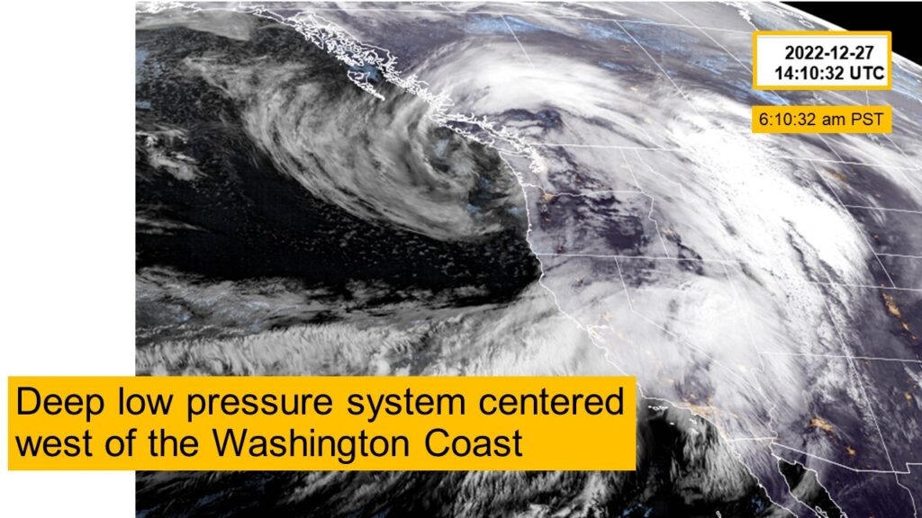
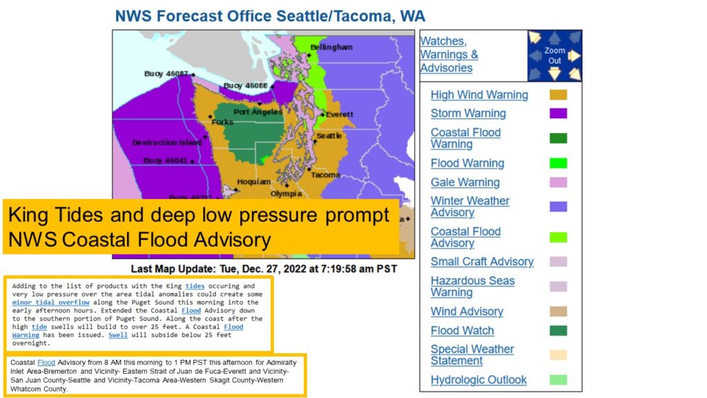
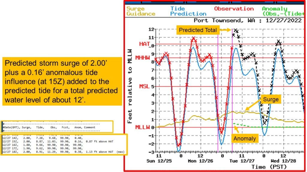
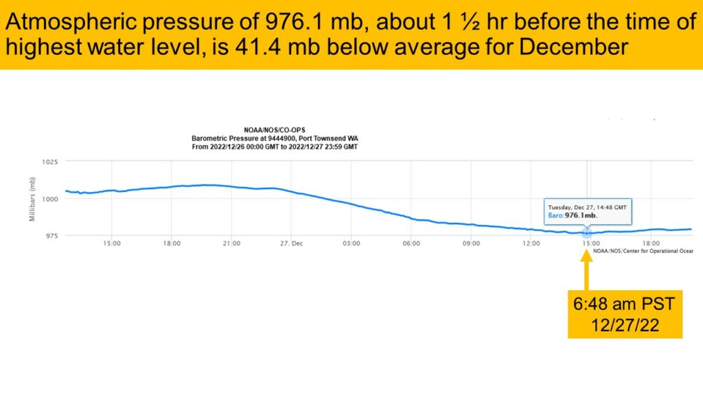
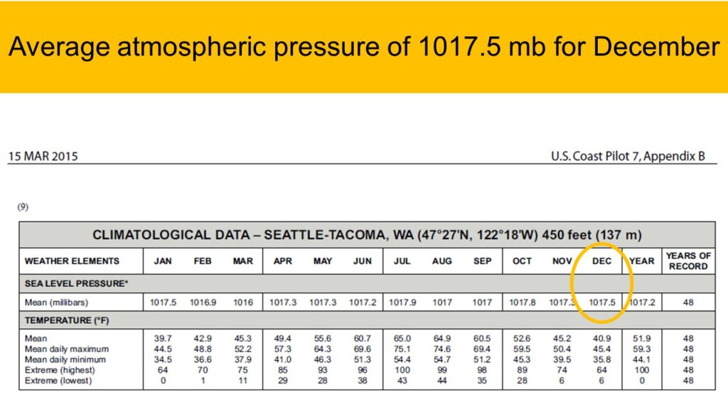
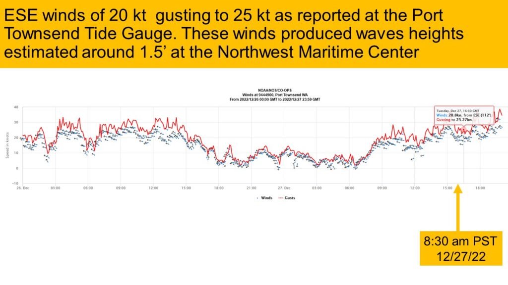
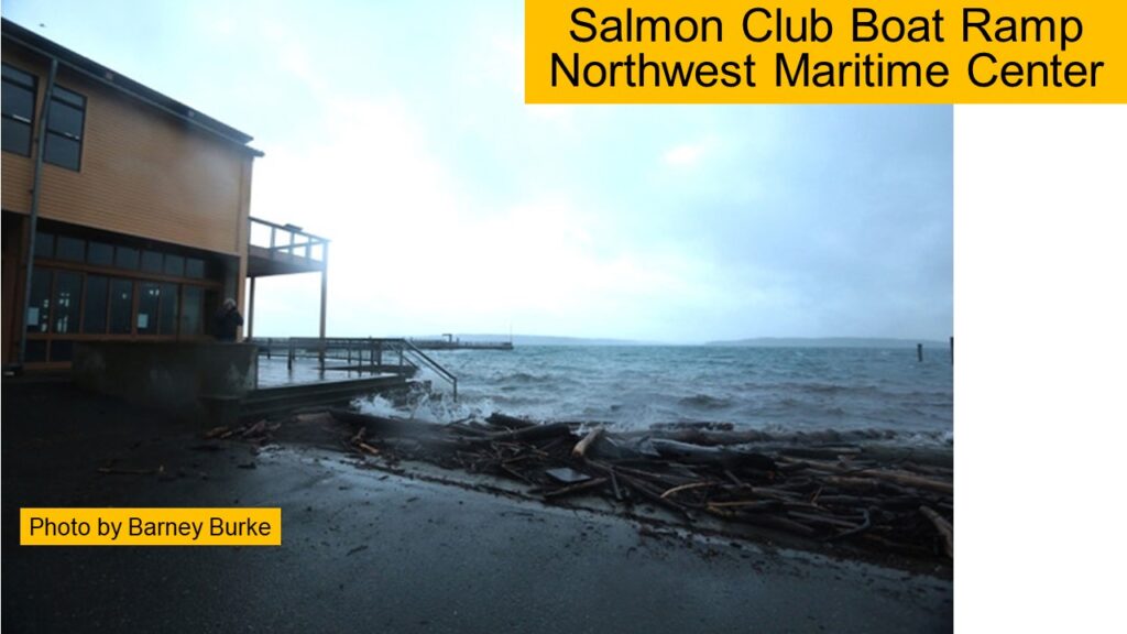
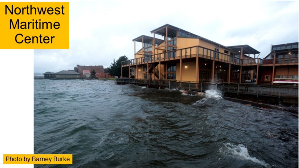
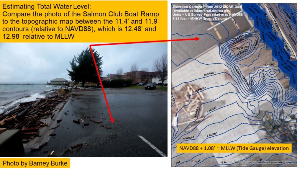
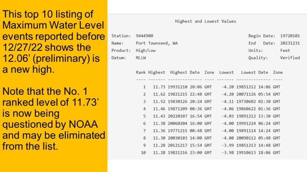
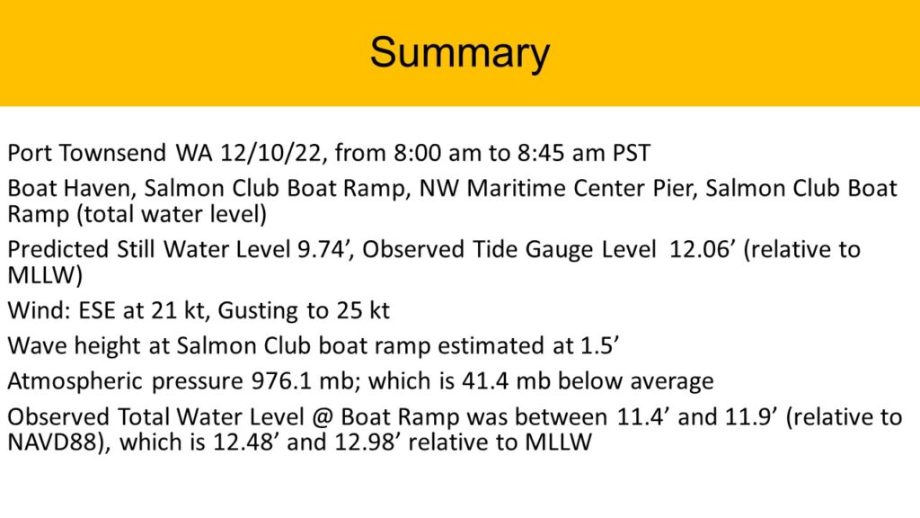
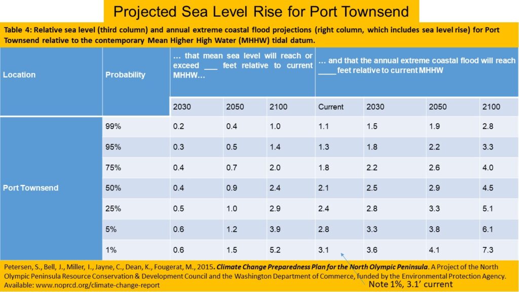
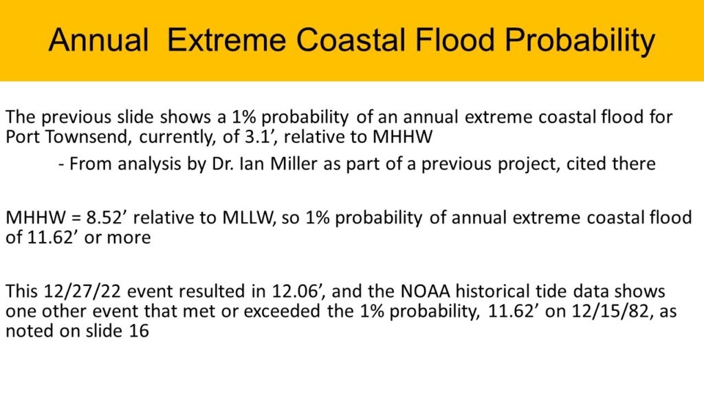
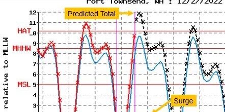
A low pressure system and south wind that occurred along with a high astronomical tide (9.74′) resulted in a 12.06′ tide (preliminary) in Port Townsend on 12/27/22, which would be a new highest tide for Port Townsend. (It takes NOAA a few weeks to verify the readings.) Read below to see the details of the weather system, historical tides, and how it aligns with the annual extreme coastal probability model done for Port Townsend previously.
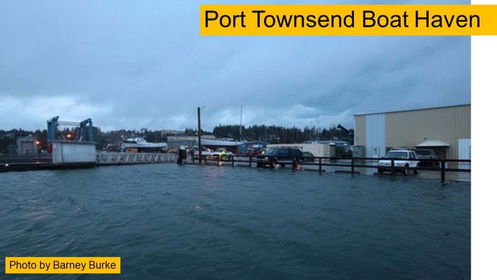
The high water level caused flooding in Boat Haven, and may have damaged a sewer main.
Interestingly, this very high total water level was predicted on NOAA’s experimental storm surge tool, which has data for Port Townsend (see here for disclaimer on the site.). If you are impacted by higher tides, the tool is a great resource to see what might be coming. We have a variety of 9′ or higher astronomical tides occurring through January, so it is a good chance to try out this tool to see if preparations are needed!
You can learn more about our King Tide monitoring project in this post. The photos from the project are shared on the MyCoast website (you can zoom in on the map to find the Port Townsend photos.) Questions or comments can be sent to the Local 20/20 Climate Group at cag@l2020.org.
